


The La Tania Interactive Map
Plus location maps, piste maps and the resort layout
Latest Resort Maps and Downloads from Courchevel Tourist Office - Winter 2022
2022 Courchevel Tourist Brochure
2022 Hiking / Footpath Map
2022 Cross Country Skiing Map
2022 Discover The 3 Valleys Without Skis Guide (but use the ski lifts!)
2022 Art at the Summit Guide
Courchevel Family Guide (2020)
Heritage Guide
2022 Resort Village Maps
La Tania | Courchevel 1850 | 1550/1650 | Le Praz/St Bon
All 2022 Piste Maps for the 3 Valleys
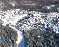 |
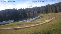
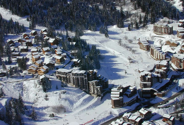
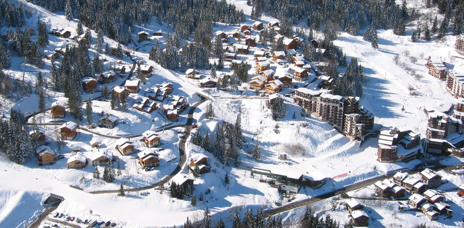
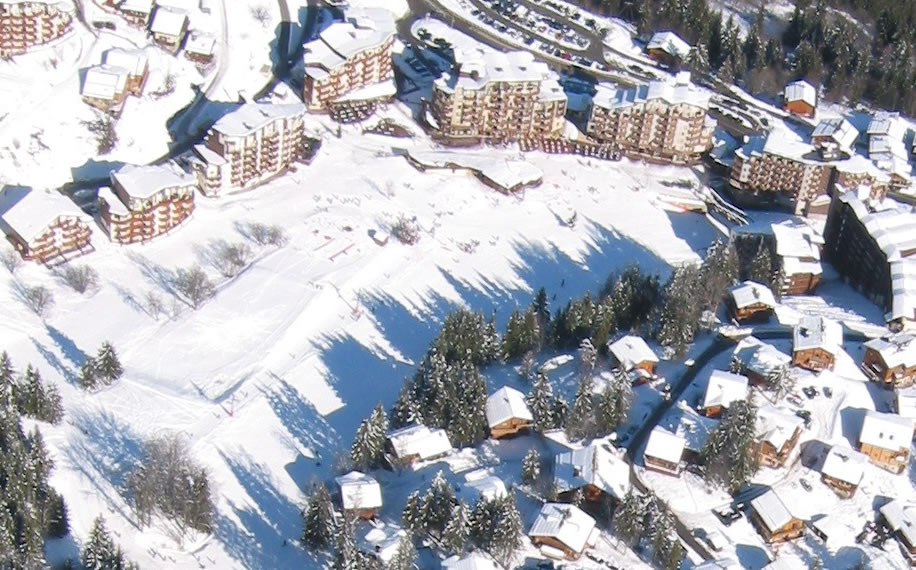
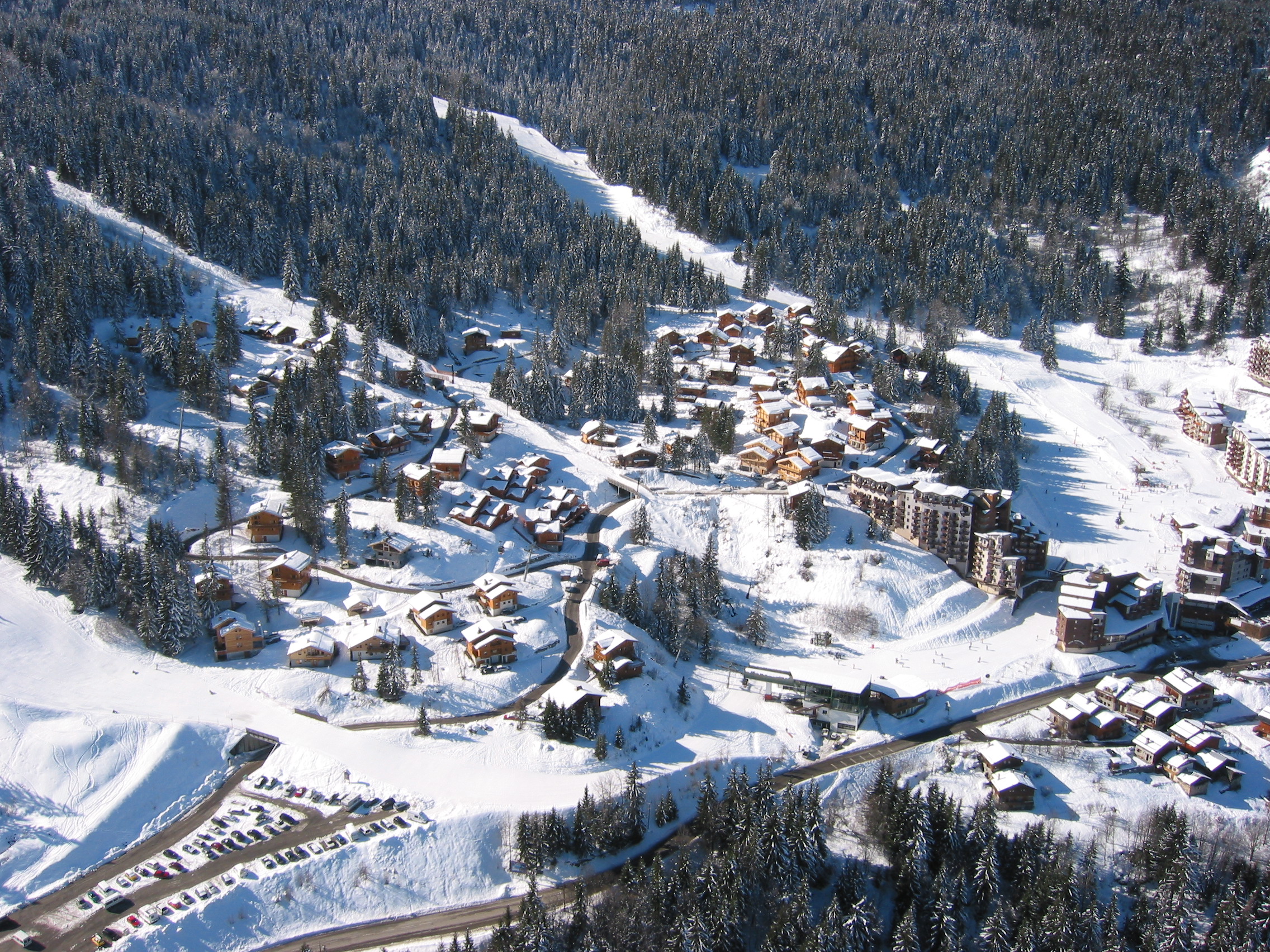
La Tania Interactive MapAerial Photograph of resort with all the main features, pistes, lifts, shops, bars, restaurants, hotels and chalets highlighted by clicking the place.Side Aerial , The Chalets and Centre Aerial Pics |
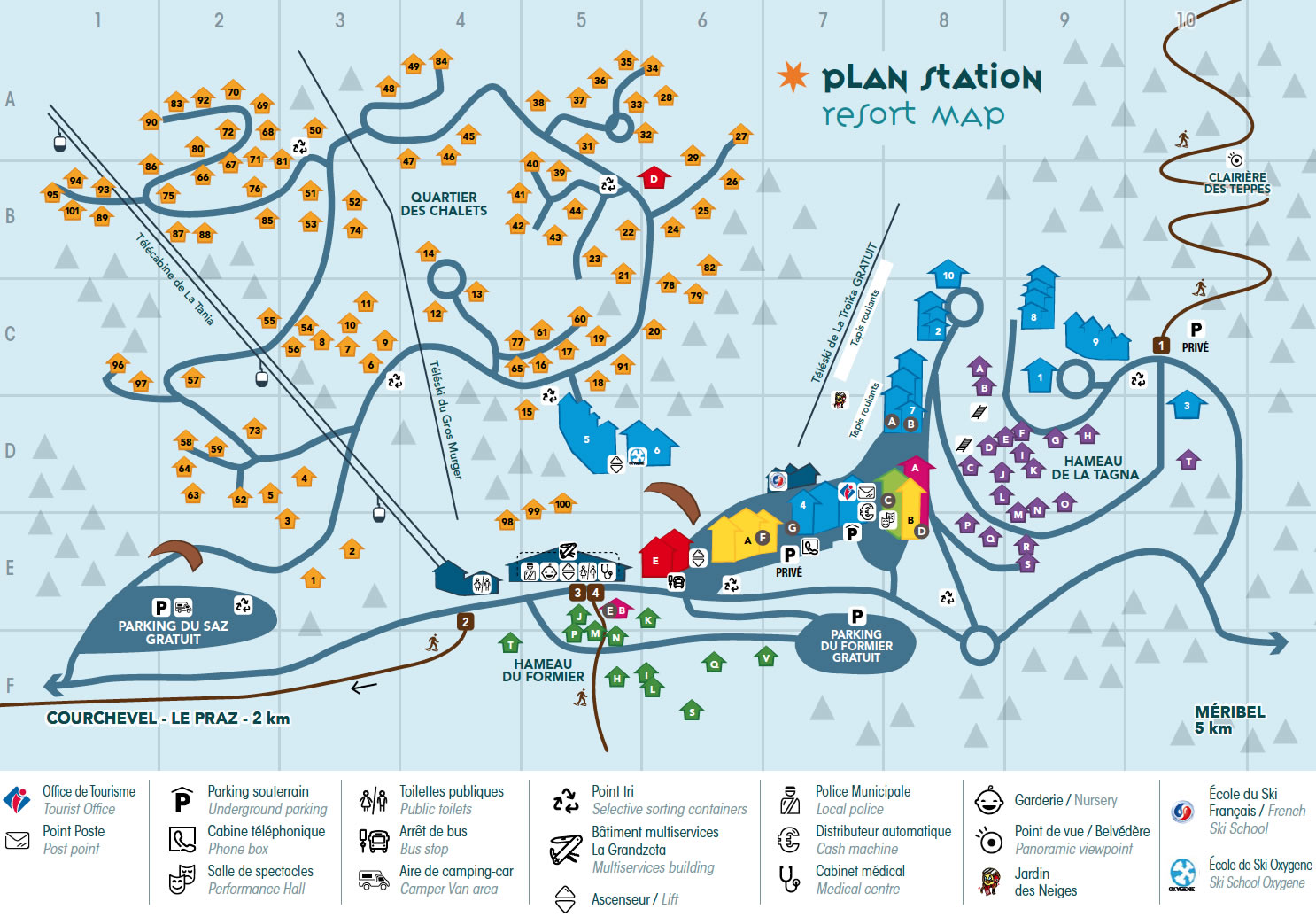 |
Resort Villages - 2021 Map DownloadOlder... La Tania 2016 (with Chalet Names back then)Le Praz & St BonMeribel | MottaretMeribel Village | Les AlluesMeribel, Mottaret, Les Allues PDF Download (62Mb!) |
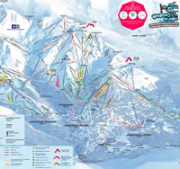 |
The 2022 Piste Maps of The 3 ValleysLa Tania & CourchevelMéribel & MottaretLes Menuires & St MartinVal Thorens & OrelleDisabled Skiers Piste Access & Information |
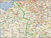 |
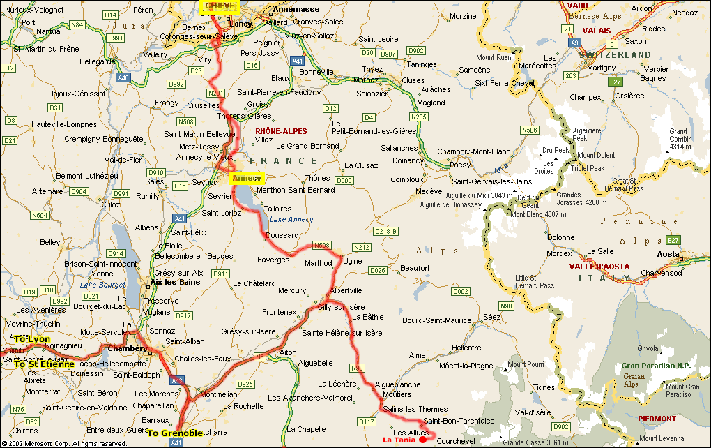
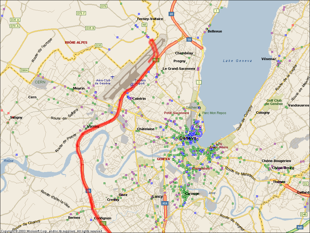
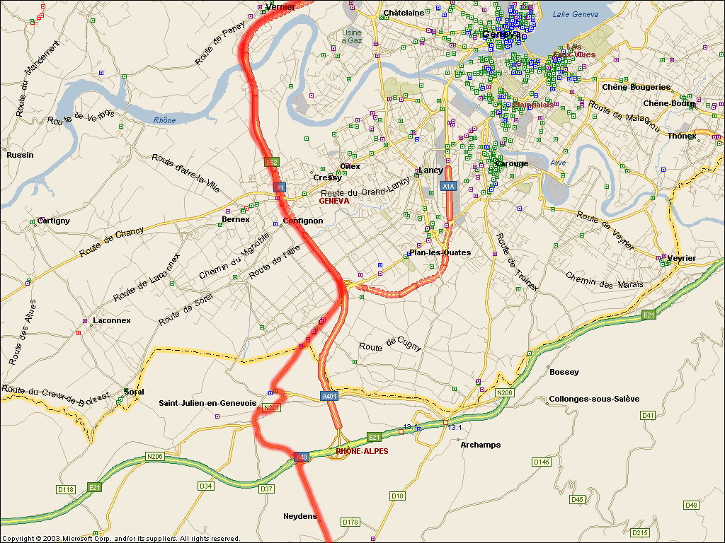
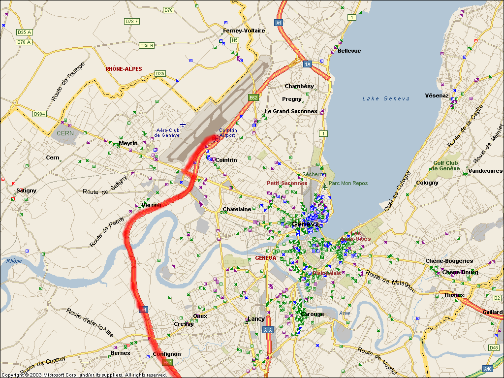
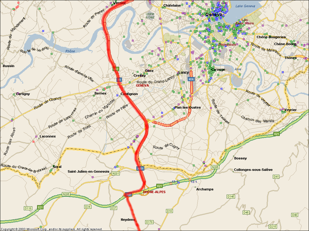
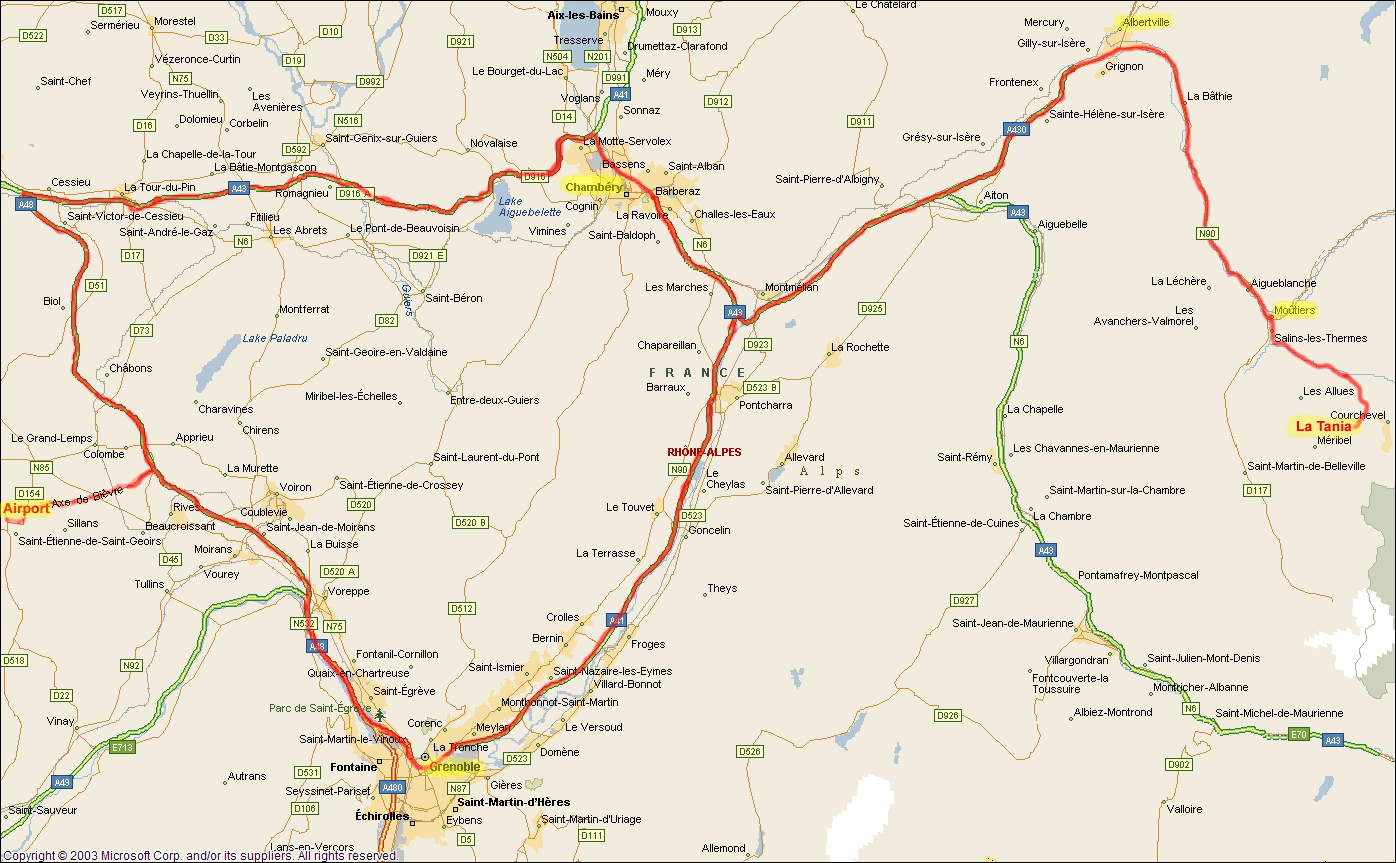
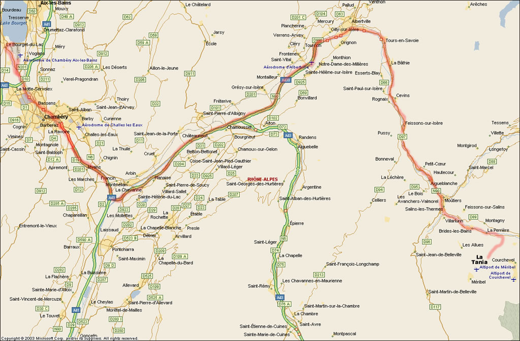
La Tania route map - Calais to the Three Valleys.La Tania location map - Direction from the airports (full driving info on the Driving to La Tania page).Geneva Airport (French side) & border crossing.Geneva Airport (Swiss side) & border crossing.Grenoble & Chambéry Airports routes to La Tania |
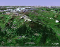 |
Satellite Pics of the Three Valleys from Google Earth.More Aerial Photos around La Tania including Le Praz and views over the Folyères Piste.Google Street View of La Tania and "Piste View" of some of the Méribel Pistes. |
Thanks to Ferg at Ski Deep for the great shots while paragliding
Full size compressed image here and Hi Res (2MB) Image of Chalets


