


The La Tania Ski Blog
Latest news, snow, pics, gossip and information from the locals in La Tania – latania.co.uk
All the latest news from around the Three Valleys from the La Tania locals. A real blog since 2006, not just endless re-posts for search engine optimisaton! Photos, gossip, snow reports, what's on and all the latest on the Apres Ski scene... Now fully optimised for iPhone, Touch and Android Mobiles - just go to latania.co.uk/blog and view on your phone. Our other past blogs & favourites here
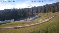
Final Day La Tania

Wonderful morning skiing around Courchevel, more marmottes than people. Piste M excellent. All runs above mid-station La Tania were open today. Lunch at Bouc Blanc and final run from the top of Loze all the way back down into La Tania village, Folyeres still open. Have a great summer!
Nick Ski


Lovely groomed Black Runs off Saulire and still fresh snow high up

In the last 2 days Creux Noir, M, Pylon, Suisse all groomed, snowing at top
now and snow holds well to midday and getting cold again, fantastic… see
pic, was Sunday and got caught out in VT!
VT to Val D Ski Challenge 24/25 April. Good Luck La Tania locals

Val’T to Val’D off the beaten track
Check out the Fan Page at:
http://www.facebook.com/pages/ValT-to-ValD-off-the-beaten-track/118937834783616
The Route: Total Ascent = 2570 meters Total descent = 5043 meters
All meters are levels above sea level. Ascents and descents are in vertical
meters so do not give an indication of actual distance travelled which is
much further than the vertical distance.
Day one-
Map3534 OT Les Trois Vallèe Modane Park National De La Vanoise.
• Mini Bus From Bozel, Courchevel to our starting point Val Thorens at the
bottom of the Telesiege des Cascades 2250 meters (the bus has kindly been
provided by Family Friendly Skiing and driven by Matt Foy
• Take first lift from Val Thorens Telesiege des Cascades to 2800 meters
• Descend to 2394 meters (406 meters of descent) to take the Telesiege de la
moraine and
telesiege de col to 3114 meters.
• Ascend across the Glacier de Chavière, through the Col de Gébroulaz
highest point 3434
meters. (320 meters of ascent)
• Descend across the Glacier de Gébroulaz around the south face of the
Aiguille De Polset across the Dôme de Polset to the edge of the Glacier 2737
meters (697 meters of Glaciated descent)
• Continue descent past ʻLac Blancʼ south face of ʻles Galeriesʼ past
ʻRefuge de la Pèclet Polsetʼ and continue following the Doran de Valpremont
(stream) towards Pralognan-la-Vanoise as far as the snow will take us
approximately 1592 meters. (1145 meters of descent)
• Picked up by the 1987 Panda 4 x 4 and driven through Pralognan-la-Vanoise
to the other side of the valley at Les Flontanettes car park 1644 meters, if
we are lucky and the snow melts, if not we will be dropped at 1464 meters
adding 200 meters of ascent to out trip.
• Ascend from Les Flontanettes car park 1644 meters past Pont de la Glière,
Lac des Vanches
around the Aiguille de la Vanoise to highest point of 2531 meters. (887
meters of ascent)
• Descend to Refuge de Col de la Vanoise 2516 (15 meters of descent)
Enjoy a good nights sleep in the refuge!! after a total of 1207 meters of
ascent and 2263 meters of descent.
Day 2-
Map3633 OTTignes. Val dʼIsère Haute Maurienne Park National De La Vanoise
• At first light depart from Refuge de Col de la Vanoise 2516, ascend Seuil
de Ouille to
Glacier de la Grande Casse 2660 meters. Continue ascent across Glacier de la
Grande Casse to Col de la Grande Casse, highest point 3096 meters (580
meters of ascent)
• Descend Across Glacier de Rosolin towards Glacier de Rosolin derriere 2770
(326 meters of
descent)
• Descend Glacier de Rosolin derriere 2770 to the base of the Pramecou 2250
meters (520 meters of descent)
• Ascende Pramecou and across the Glacier de Pramecou the col de Pramecou
3033 (783 meters of ascent)
• Descend to Val Claret Tignes 2107 meters (926 meters of descent)
• Take the Teleisage de Bollins-Fresse 2598 meters descend to bottom of
Teleisage des
Marmottes 2410 meters (188 meters of descent).
• Take Teleisage des Marmottes to 2662 meters.
• Descend to Val dʼ Isère 1842 meters (820 meters of descent).
Enjoy a good cup of hot chocolate somewhere in Val dʼ Isère!! after a total
of 1363 meters of
ascent and 2780 meters of descent.
• Mini Bus From Val dʼ Isère to Bozel, Courchevel (the bus has kindly been
provided by Family Friendly Skiing and driven by Matt Foy
• Total Ascent = 2570 meters Total descent = 5043 meters
LT still open, still got snow but an invite to Lords got in the way

We’re on the pitch… At the home of cricket…


Beautiful Day, Charity Day

First lift on perfect groom slopes and a few inches of fresh. As good
as it gets…
All White Again In La Tana – will Winter ever end?

Snowing hard Monday evening, may be a first lift Powder Day tomorrow…


